GRANITE PEAK PUBLICATIONS: Accompanying travelers to the national park since 2002

All posts tagged map

An American horsewoman in 1916

Categories: History, Through Early Yellowstone
Comments Off on An American horsewoman in 1916
Alice Morris Yellowstone Trails map

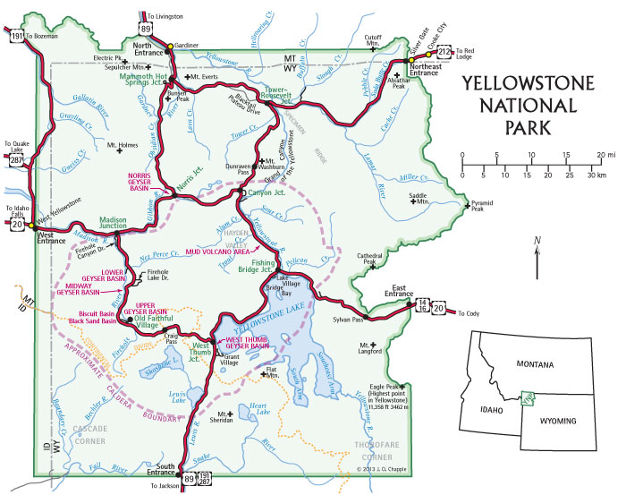
Lower third of the “Yellowstone National Park Trails Map,” prepared by Alice Parmelee Morris in 1917, one of five wonderful maps reproduced in Through Early Yellowstone

To celebrate Women’s History Month, here’s an excerpt about a remarkable woman, Alice Parmelee Morris. This story was originally published in the New York Times in 1918, two years after she made the trip.

Yellowstone Trails Blazed by New York Woman

Mrs. Robert C. Morris Has Laid Out Complete System of New Paths for the Government, Opening the Park’s Wild Beauty to Horseback Riders

It is almost two years since, in the words of official statement, “the Yellowstone National Park was opened to automobiles,” and the fear has been general that the coming of the motor cars and the passing of the ancient stage coaches would rob that wild and magnificent mountain land of much of its charm, and, indeed, of its enjoyment. But the fear that “the Yellowstone would be spoiled,” that opportunities for pack trains and horseback riding would be less, turns out to be just the opposite. They will be more.

The National Park Service of the Department of the Interior has recently accepted a complete mapping of projected trails through the vast extent of the Yellowstone National Park. Work is to begin on the actual cutting of the trails as soon as possible. Back of its neat lines and dots and tracings lies a great amount of rugged, courageous, brilliant work. It is the sort of work which any one would think must be done by a forester or a professional mountaineer or surveyor.

But it was not. It was done by Mrs. Robert C. Morris, a New York woman who has a ranch on the borders of the park and spends her Summers in the Yellowstone because she loves it and who gave the whole of last Summer, and rode fifteen hundred miles on horseback, to plan the Yellowstone trails.

. . .

What Mrs. Morris has done is to map out an elaborate system of trails through the park which will make it possible for visitors to ride through the most beautiful and picturesque portions of the great “reservation,” journeying in an unhurried and enjoyable fashion, seeing much that cannot be seen from the motor roads alone, and never once traveling on the motor highways. What is more, the trails are arranged so that trips can be made in a day, a week, a month, or more. . . .

Mrs. Robert C. Morris, born Alice Parmelee in New Haven, Connecticut, about 1865, was descended from a Revolutionary War soldier in the Connecticut militia. In 1890 she married Robert Clark Morris, a New York City lawyer interested in international law, and in 1897 she published Dragons and Cherry Blossoms about her trip to Japan. Mrs. Morris was an avid horsewoman who became enamored with the scenery of Yellowstone Park and spent many summers at the Silver Tip Ranch just north of the park. In 1917 she conceived, financed, and carried out her remarkable plan to explore and map an interconnected loop of trails throughout the park and environs.


Excerpted from pages 231, 233-34, and 235 of Through Early Yellowstone: Adventuring by Bicycle, Covered Wagon, Foot, Horseback, and Skis.

Reader feedback on geology

Categories: Science
Comments Off on Reader feedback on geology

Yellowstone geology map

Geological Setting of Yellowstone National Park (click for larger version)

Recently we heard from someone who found our article on Beartooth Butte confusing, so I revised that “Nugget” to be clearer. We describe a geological feature you can see if you drive outside the Northeast Entrance of Yellowstone National Park toward Red Lodge, Montana. The part we had to clear up is that Beartooth Butte is in Wyoming, but the Beartooth Range is almost wholly in Montana. The butte sits above a lake with the same name, about 20 miles on US Highway 212 from the state line.

Did you know that geologist Jo-Ann Sherwin and I spent a lot of time updating the geology in the latest edition of Yellowstone Treasures? This map we revised is the most technical one, not intended for navigation like most of the 38 maps in the guidebook! Besides the types of rock in the different mountains, the map shows calderas. (A caldera is a large circular or elliptical crater or depression formed by the collapse of a large land area after the emptying of a magma chamber in a massive volcanic explosion.) Notice how the most recent—and famous—Yellowstone Caldera is marked with a solid line because much of its edge is visible at the surface. Meanwhile, the Henrys Fork and Huckleberry Ridge Calderas have a dashed outline to show that the caldera edge is buried under more recent volcanics. East of the park, the dotted outlines of the Heart Mountain detachment and its remnants show their general size, shape, and location. These are large chunks of Paleozoic sedimentary rock that became detached from the underlying rock and slid to the southeast over the Bighorn Basin. There’s lots more to explain calderas and other geological formations in the guidebook’s Geological History chapter.

We welcome your feedback on either our books or this website. Contact us!
—Editor Beth Chapple

Map credit: Jo-Ann Sherwin adapted this map with permission from Mountain Press’s Roadside Geology of Wyoming, 2nd ed., 1991, by David R. Lageson and Darwin R. Spearing.

Elsewhere on this website you can read about “The Yellowstone Caldera” and the Heart Mountain Interpretive center: https://www.yellowstonetreasures.com/2013/07/14/trip-report-heart-mountain/.

Explore all our guidebook editions

Categories: History, News
Comments Off on Explore all our guidebook editions

Curious about how Yellowstone Treasures has changed over time? Of course, every edition has updates covering finished and ongoing park construction, geyser basin changes, and advances in science. And we always correct the text to reflect changes in the Park, even in the reprints. Here we go, from the most recent back to the very first edition.

Yellowstone Treasures cover

Sixth edition (May 15, 2020). ISBN: 9781733103206

Special features of the sixth edition:

  • Cover photo by Janet Jones of SnowMoon Ink, Cody, Wyoming
  • Extensive text and diagram updates by editor Beth Chapple and geologist Jo-Ann Sherwin
  • Descriptions of the new overlooks on the South Rim of the Grand Canyon of the Yellowstone, the new trail to the Grand Prismatic Spring overlook, Steamboat Geyser’s resurgence in March 2018, and the surprise eruption of Ear Spring in September 2018
  • Map updates and one new map by Jennifer Johnston of Inspirit Cartographics.


Yellowstone Treasures 5th edition cover

Fifth edition (2017, reprinted 2018). ISBN: 9780985818272

Special to the fifth edition:

  • Cover designed by Vicky Vaughn Shea of Ponderosa Pine Design with a photo by Stephen Michael Gryc, composer and geyser gazer, chosen as part of our summer 2016 photo contest
  • Won Silver in Independent Book Publishing Association’s Benjamin Franklin Awards in 2018
  • 65 new photos, many resulting from our photo contest or from Suzanne and David Cane
  • Revisions to the glossary of geological and other scientific terms by Jo-Ann Sherwin


Yellowstone Treasures 4th edition cover

Fourth edition (2013, repr. 2015). ISBN: 9780970687388

Special to the fourth edition:

  • Cover photo of Old Faithful Geyser by geologist and family friend Don Forsyth, continuing the theme inspired by the old Haynes guides
  • Text updates by author Janet Chapple
  • A dozen new pictures
  • 37 maps fully revised by mapmaker extraordinaire Linton Brown
  • Thorough update of the geological information and a new glossary by geologist Jo-Ann Sherwin
  • Book expanded to 400 pages
  • Color tabs to indicate the six sections of the park


Yellowstone Treasures 3rd ed. cover

Third edition (2009, repr. 2011, 2012). ISBN: 9780970687333


Special to the third edition:

  • Cover focuses on Don Forsyth’s Old Faithful Geyser photo to evoke the covers of the old Haynes guides, published almost every year from 1890 to 1966
  • Won Silver in IBPA’s Benjamin Franklin Awards in 2010. One judge wrote: “The third edition is a charm. I can’t think of any way to improve this book; it is well-researched, easily accessible and shows great love of place.”


Yellowstone Treasures 2nd ed. cover

Second edition (2005, repr. 2007, 2008). ISBN: 0970687311

Special to the second edition:

  • Cover features the photo of Old Faithful Geyser by geologist and family friend Don Forsyth, along with insets of black bear cubs and Tower Falls
  • Author Janet Chapple updated campground information and geyser activity
  • Expanded section on wolves
  • Book expanded to 392 pages
  • Colors for each road log section added to the tops of pages to aid in navigation


Yellowstone Treasures first edition cover

First edition (2002). ISBN: 0970687303

Special features of the first edition:

  • Cover designed by Elizabeth Watson with photos of Old Faithful Geyser, fireweed, sandbar and lagoon near Yellowstone Lake, mule deer. Lower Falls of the Yellowstone River, bison, and Mammoth Hot Springs
  • Won Gold in Foreword Reviews’ Book of the Year Awards, 2002
  • Author Janet Chapple wrote the 384-page book, from recommendations on the best sights and organizing the six road logs to the chapters on natural and human history
  • Geologist and husband Dr. Bruno Giletti wrote the geology chapter and took most of the original photographs during their many years of trips to the Park
  • Family friend Linton Brown creates 37 maps
  • Informational sidebars are tinted according to their topic: geology and geography, human history, natural history, and park information

Spring is in the air

Categories: Trip planning
Comments Off on Spring is in the air

overview map of Yellowstone

Click for larger map.

As the snow starts to melt, the roads in Yellowstone National Park will be plowed and cleared in readiness for letting cars and trucks back in. (Of course, the road from the North Entrance at Gardiner, Montana, through the park to Cooke City, Montana is open all year. But notice that travel east of Cooke City via the Beartooth Highway is not possible from late fall to late spring.) Here are dates to use in your planning this spring.

2019 Winter Closing Dates

Roads will close to oversnow travel by snowmobile and snowcoach at 9 pm on the following dates:

  • March 1: East Entrance to Lake Butte Overlook (Sylvan Pass)
  • March 3: Mammoth Hot Springs to Norris
  • March 5: Norris to Madison, Norris to Canyon Village
  • March 10: Canyon Village to Fishing Bridge
  • March 15: All remaining groomed roads close.

2019 Spring Opening Dates

Conditions permitting, roads will open to regular (public) vehicles at 8 am on the following dates:

  • April 19: West Entrance to Madison Junction, Mammoth Hot Springs to Old Faithful, Norris to Canyon Village.
  • May 3: East Entrance to Lake Village (Sylvan Pass), Canyon Village to Lake Village.
  • May 10: South Entrance to West Thumb, Lake Village to West Thumb, West Thumb to Old Faithful (Craig Pass), Tower Junction to Tower Fall.
  • May 24: Tower Fall to Canyon Village (Dunraven Pass)
  • May 24: Beartooth Highway

Credits: The image is the overview map on pages 1-2 of Yellowstone Treasures. The helpful National Park Service Park Roads page provides the dates listed here and a live road map you can use to find out which roads you can drive on today.